
Duluth Neighbors: Block Sources
There is no official online roster of everyone living around a Duluth address. The best documented Duluth starting point is a legal parcel boundary. St. Louis County GIS for Duluth identifies the parcel under an address and the parcels beside it. Duluth property and tax tools add property facts and taxpayer or owner context. Duluth community-club pages and neighborhood plans identify civic geography, not private membership. For historic Duluth households, the library's post-1930 street sections offer a dated snapshot rather than a current block list.
| Source | What It Shows About a Block | Access |
|---|---|---|
| St. Louis County Land Explorer for Duluth | Duluth parcel boundaries, address points, nearby PINs, map layers, and links to property tools | Duluth online map, county GIS help, or office assistance |
| Duluth Property Details and tax lookup | Duluth property characteristics, parcel context, and the distinction between taxpayer and property data | Online, St. Louis County Assessor’s Duluth office, or Chapter 13 route |
| St. Louis County Recorder and RecordEASE in Duluth | Duluth recorded instruments and title history tied to a parcel or legal description | Paid online access, Recorder terminals in Duluth, copies, mail, email, or fax |
| Duluth community clubs | Named Duluth community organizations and meeting or contact context | Duluth city page and direct organization contact |
| Duluth city directories | Dated Duluth street-section entries for households after 1930 | Duluth library stacks, in-library databases, archives, and historical collections |
Duluth parcel data does not prove occupancy. A title holder may be a trust, estate, corporation, public entity, or nonlocal contact. A Duluth taxpayer mailing address can be somewhere else. Likewise, a Duluth street-directory entry can reflect a past resident, boarder, business occupant, or owner. Treat every Duluth source as one observation with a source date.
Map a Duluth Block in Land Explorer
St. Louis County Land Explorer is the clearest official route for a Duluth block-level search. Search a Duluth address, open the map result, and inspect the parcel outline before looking at nearby parcels. The county provides Duluth layers for address points, cadastral parcels and labels, road labels, boundaries, public lands, zoning, and historical imagery. The map pop-up can connect to Duluth Property Details and Parcel Tax Lookup, making it possible to document where each field came from.
The St. Louis County GIS web-services screen for Duluth is a useful reference for the available map and imagery layers.
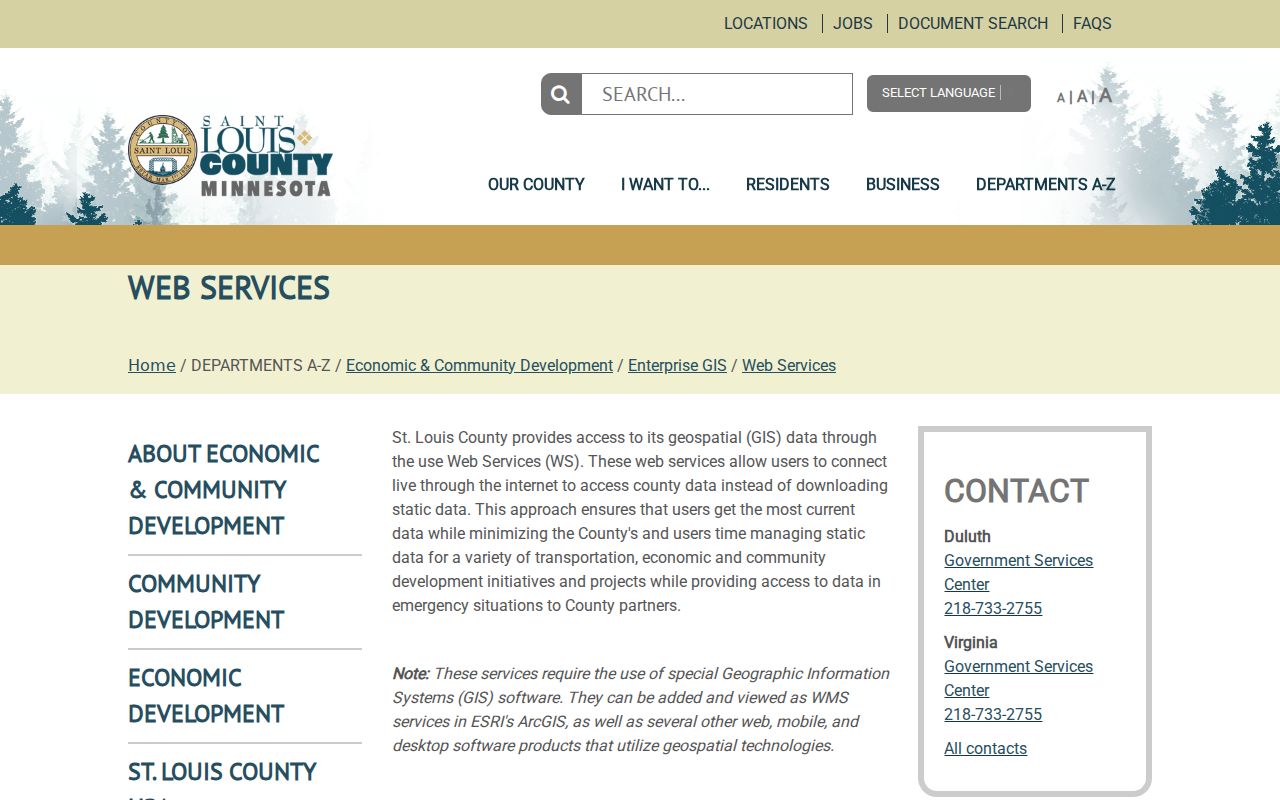
Duluth map layers help identify the actual block shape. They do not show a complete list of people at nearby addresses, and a roof that looks close on an image is not necessarily on an adjoining Duluth parcel.
Use Duluth road centerlines, alleys, public land, water, and plat boundaries with the parcel outlines. A legal neighbor can be separated by an alley or a common tract. Another Duluth property may share a parcel while carrying a different physical address. That is why the PIN and legal description deserve more weight than visible proximity.
Duluth Neighbor Addresses Need Labels
St. Louis County GIS for Duluth distinguishes physical, taxpayer, and owner addresses. They can differ. A Duluth parcel can carry several physical addresses, while the map search uses an arbitrary primary physical address. The owner address is a person or entity contact field. The taxpayer address is where a bill may be sent. A Duluth directory address is a dated occupancy observation. None should be rewritten as one general address for a Duluth neighbor.
- Physical or situs address
- The location of the parcel or building. It is the best starting point for the map, but one parcel may have more than one physical address.
- PIN or Parcel ID
- The county's identifier for the parcel. It gives a more stable link among the map, property tools, and recorded-land research.
- Taxpayer address
- The mailing contact shown for tax purposes. It can differ from both the property location and title holder.
- Plat and legal description
- The recorded land description used to identify the exact tract, lot, block, or other legal area. It is stronger than a casual description of what is nearby.
When a full Duluth address fails in Property Details, the county suggests trying the number alone or an abbreviated street segment. Use Duluth official direction and street abbreviations, then confirm the returned parcel on the map. The public search page is address and characteristics oriented; it does not promise a universal owner-name search.
Duluth Neighbors Across Civic Boundaries
A block can be part of several different Duluth geographies at once. The city has 34 precincts across five council districts, but a precinct is not a neighborhood and neither is a ZIP. County parcels and postal areas follow other systems. Official Duluth-area materials caution that 55810 and 55811 overlap nearby communities and include small embedded ZIP contexts. A ZIP by itself does not establish Duluth city residency.
The Duluth precinct maps provide the civic boundary layer for an address. The supplied capture shows that official lookup route.
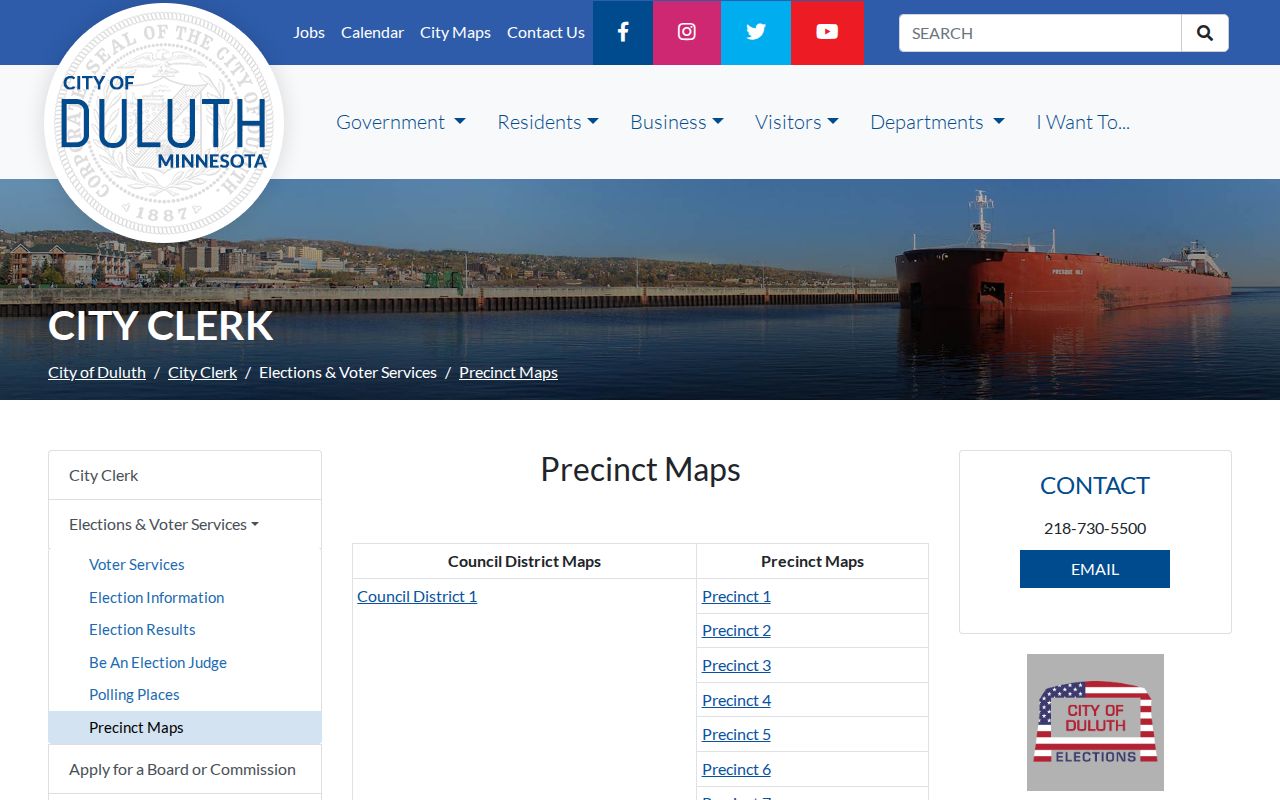
Use a precinct map to understand representation and election geography, not to infer which people live on a block. The Minnesota voter-status service is individual and the public voter-list process is restricted to registered Minnesota voters making a permitted request under Minn. Stat. §201.091.
For mail formatting, USPS ZIP Code Lookup is the current address tool. For parcel location, use Land Explorer. For census statistics, a ZCTA is only an approximation of postal delivery geography. Keep each layer separate in block notes.
Map a Duluth Block Parcel by Parcel
One address can become a careful block map without turning it into a personal dossier. The county's own neighbor workflow starts with a parcel selection, then records adjacent parcel IDs and checks legal boundaries. From there, property or recorded-land research may explain ownership context. If the purpose shifts to a full street history, use the dedicated street research instead of expanding one small block without a clear need.
- Validate the street address with USPS, then search it in Land Explorer using the county's abbreviation rules.
- Open the parcel and record its PIN, primary physical address, tax district, map date, and legal-description clues.
- Click each adjoining parcel and record its PIN separately. Check for roads, public land, alleys, water, or shared parcels before calling it adjacent.
- Use Property Details or the tax card for property context. If a recorded instrument is relevant, search the Recorder by legal description, document number, grantor, grantee, or cross-reference.
- Stop at the information needed for a lawful civic, property, or historical question. Do not assemble a routine, contact list, or protected location.
For a named road rather than the immediate block, the Duluth Street Directory follows the broader address-records chain.
Duluth Neighborhood Groups Give Context
Community sources belong in a neighbor search only as geography and civic context. The City of Duluth's community-club page lists local organizations with contact and meeting information. These are not private member lists. They can help identify a community conversation, park activity, or recognized neighborhood context after the parcel work is complete.
| City-listed Duluth community organizations | Appropriate block-level use |
|---|---|
| Gary New Duluth; Harrison; Irving | Identify community-club context and consult the city's current contact or meeting information. |
| Lakeside-Lester Park; Morgan Park/Smithville; Park Point | Connect a parcel area to a community group without treating a group page as a resident roster. |
| Neighborhood plans | Understand planned geography and historical land use, rather than current private households. |
The neighborhood-plans page is the source for the captured planning material below.
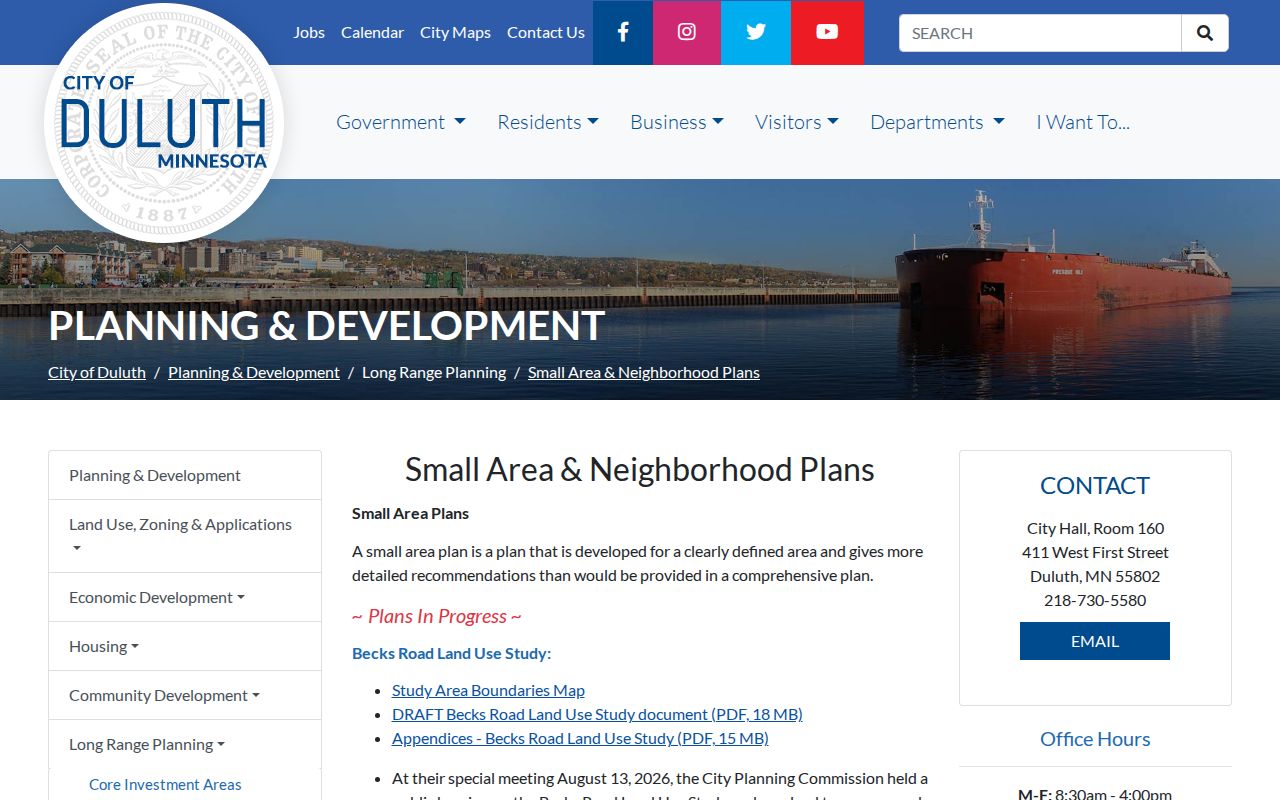
West Duluth, Morgan Park, Hillside, Lincoln Park, Spirit Valley, and Becks Road planning materials can add context to an address. Their boundaries still should not be substituted for a parcel line, precinct, or ZIP.
Note: Community-club contact information changes, so use the current City of Duluth listing before reaching out about a meeting or local project.
Historic Duluth Neighbors by Street Section
Historic directories are useful when the question is who appeared near an address at a particular time. Duluth Public Library lists city directories as 1883 to present and describes 1884 to 1960 in-person holdings and searchable Ancestry access. Its catalog notes missing issues for 1919, 1933, 1945, 1947, 1949, 1953, and 2008. UMD describes an overlapping 1882 to 2002 run with some missing, so the collection source and year should be recorded rather than blended into one perfect sequence.
The first street-by-street Duluth city directory appeared in 1930. Earlier volumes are mainly alphabetical resident and business lists. A street section can show a period neighborhood snapshot, but it cannot prove who occupies the block now. Confirm an entry through the date, address, newspaper, deed, permit, or another suitable source.
Duluth's community-club page is shown below because present community geography and historical directory geography answer different questions.
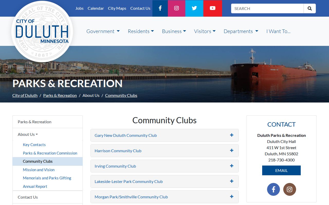
The city page supplies civic context, while the library's directories provide dated printed observations. Neither replaces a current legal parcel boundary.
Duluth Neighbor Sources Compared
Official records have defined custodians, field limits, dates, and request channels. Commercial neighbor products can compile data from unknown dates or sources and may blur owner, taxpayer, and occupant information. The official route can take more steps, but it makes it possible to check a record's context and ask the office that actually holds it about a missing field or error.
| Official Duluth and Minnesota records | Commercial neighbor products | Better practice |
|---|---|---|
| Show the custodian, record category, access limit, and source date | May combine old or mismatched address and name information | Confirm a property fact with County GIS, property tools, or the Recorder. |
| Offer a specific correction, copy, or request route | May not show the original source or classification | Ask the actual government custodian to correct or explain its record. |
| Keep protected and restricted data out of public access | Can encourage an overbroad picture of a private person | Use only the least information necessary for the lawful question. |
Duluth Neighbor Research Access Channels
Online access is only the first channel. The Assessor can help with property data at the Duluth Courthouse and at A.P. Cook, while the Recorder and Registrar of Titles maintains public terminals at 100 N 5th Ave W #101. RecordEASE requires a paid subscription for online land-record searching. For copies, the Recorder accepts requests in person, by mail to PO Box 157, by email at slcrecorder@stlouiscountymn.gov, or by fax at 218-725-5052. It asks for the document number when known and whether the document is Abstract or Torrens.
City property history and permits have their own route: ePlace for public search, CSI at City Hall Room 100 for older records and plans, and a property-history request when appropriate. Duluth Public Library, UMD Archives, the Historical Society, newspapers, historic maps, and house-history help are the research alternatives for a past block. A narrow Minnesota Government Data Practices Act request can ask the right county or city custodian for public data when an online field is absent. Phone and email can clarify the proper office before a request is filed.
Privacy Limits for Duluth Neighbor Research
Public parcel information does not make every fact about a nearby person public. Safe at Home protects a participant's actual location behind a substitute address. Court records can have remote exclusions. Voter information has access rules. Minnesota data practices can classify fields as private or confidential. Do not use an owner or taxpayer field to claim a person lives at a parcel, and do not attempt to defeat a redaction, access control, or substitute address.
If a public record appears wrong, contact the agency that created it about its correction process. If the need is historical, state the date range and record type instead of requesting every file connected to an address. The county's public-data process supports inspection, copies, or both, with free inspection and possible copy charges above the county's threshold.
Lawful use. Use Duluth neighbor sources for lawful civic, property, and historical questions. Do not watch, harass, intimidate, or try to locate protected people; Minn. Stat. §609.749 prohibits stalking conduct.